
Ginny Lake and the Four Ten'ers
Relay Peak elevation 10,338
Houghton Peak elevation 10,490
Mount Rose elevation 10,776
Church Peak elevation 10,601
What does that even mean? Well, we hiked in to Ginny Lake and the next day we bagged 4 peaks, all of which were over 10,000 ft!! And what a day it was. We are doing a final couple of trainings to get ready for the Mount Whitney climb at the end of the month. This weekend was all about endurance. Can we really hike from dawn 'til dusk? Can we really hike 18 miles with 5,000ft of elevation gain? We are about to find out...

After work Friday and the start to Labor Day Weekend. We headed up Hwy 80 through Truckee to the Incline Trailhead. We knew it would be a late arrival, so Chris had LeeLoo all outfitted for sleeping accommodations. She's quite accommodating for all sorts of activities, but she's awesome an outdoor sleeper.
This was our view in the morning out the back hatch. Not too shabby. We are moving a little slow. No rush this morning. Just going to grab a bite to eat (Chris's breakfast burritos) and head down the trail to find a place to camp near Ginny Lake. We get up, eat up, gear up and are on the trail around 10ish.

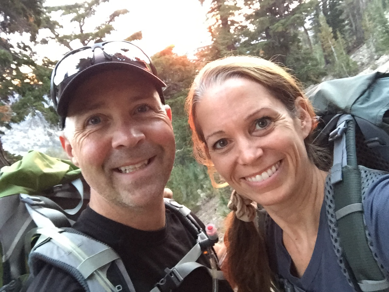
And as always, a selfie before we begin :-)

The first portion of the trail is a fire road leaving from Incline Lake Trailhead, easily negotiable for everyone. Many small trail split off from this trail, so be sure which one you need.

We leave the main trail and onto Incline Lake Downhill Trail towards Ginny Lake. This trail would continue on to Relay Peak if you stayed on it for another 5 miles, but in about a mile from here we are going to head North, off-trail to find a place to camp.

This trail is open to mountain bikes and the water crossings are in place to accommodate riders as well as hikers.

This is where we decided to leave the trail.

And head down the hill towards the marshy meadows below. There must be a lake down there somewhere! We followed a water shed down the hill and climbed up and down a couple of hills.

And then we found it! Ginny Lake! It's really more of a marshy large pond, but surrounded by a marsh and a couple of meadows. Our camping spot is situated on a peninsula that is in between two marshy areas. The lake being off to our left and a marsh and creek off to our right.

We built camp here. Right next to the lake. We could hear the water and knew we could use our filter and have plenty of water for everything we needed the entire weekend. This was an amazing spot. It had a nice level spot for our tent, a great area for our kitchen and another area with plenty of rocks to choose from to build a great fire pit. We would definitely come back here again. It was worth the 2 mile climb to get here.

After we had camp set up, we decided to explore around and get our bearings. All in an effort to make the 4am Alpine start a little easier. Don't want to be figuring out which route to take in the dark, we will figure it out now. This is the meadow that is to the right of our camp.

We got back to camp and it was time for a rest. We immediately laid out our thermarest pads on the ground and slept, hard....... Alpine naps are the best!.

And here is what a thermarest can do to your skin when you lay directly on it! I looked like some kind of strange reptile. This also was seconds before my McDonald's moment. As I was leaning in my chair to take this picture, I leaned a little too far and spilled the boiling hot tea Chris had just handed me all over my thighs. They were on fire. For a moment, I expected to see blistering skin. But luckily that didn't happen. I must have jumped up fast enough and began cooling it with cold water from the stream before any of that happened. That did not feel good at all. Thankfully, I was good to go the next day. My skin felt a little scratchy, but it certainly wasn't going to stop me from our grand adventure. Whew, close call.

We built a great fire pit and Chris had the fire going in no time. This area has very little if any signs that anyone ever comes down here, so there are plenty of resources available. Good rocks for the fire ring, plenty of firewood spread all around from a fallen tree. We could survive here in this very spot for a very long time.

We had a lovely dinner that Chris made testing backpacking recipes for Whitney. Mexican was the theme and it included, ground beef, mushrooms, peppers, corn, tomatoes, and a few other veggies with seasonings and white rice. It was all dehydrated and easily re-hydrated in hot water. We ate right out of the ziplock bags so cleanup was a breeze. This is definitely that way to go! Easy prep, easy clean up and it was a delicious homemade meal. Winning!
I then made an apple crisp in the fire. I had pre-measured out the cinnamon, sugar oatmeal mixture and added a fresh apple and water. Stirred it up, placed it in the foil and near the coals in the fire pit for about 30 minutes. It was delicious! I definitely will make this again and next time use dehydrated apples to lighten the pack weight overall.
After all of this delicious food, we were stuffed! Time to call it an early night. We've got an alpine start planned.

4am came quickly, but we did well getting up and ready. We found it took about an hour to completely make breakfast, change, pack up and be on trail. I think with a little more practice, we can make that much quicker.

The forest looks very different in the dark of night and when you can only focus on what your headlamps light...... well things can be a little spooky. Our first encounter was a scary looking log. It reminded me of the book "Where the Wild Things Are".

We are on trail and the sky is beginning to lighten as we make our way up the hill towards relay peak.

Headlamps are no longer needed. The trail is easily negotiable, even at night. This is Rose Nob. We won't be climbing this today, but it looks pretty cool with the sunrise glow cast upon it's side.

The trail continues to meander around the hillside with a gentle slope upwards. This portion of the trail now puts you on the Tahoe Rim Trail. Trail conditions are great and very well maintained.

And mother nature is going to bestow her beauty upon us with a gorgeous sunrise. One thing that we have not experienced yet together. A sunrise on trail.

It just keeps getting better and better with cotton candy embellishments and casting the orange glow of a new day all around us.

As we turn to head directly towards Relay Peak, I caught this moment when the sun finally peaked over the hillside. Picture Perfect and worth every moment of that 4am wakeup call.

We continue on and the trail is now aglow with the early morning sun.


Relay peak is up ahead.

And there is it in all it's glory... or lack of. It's really nothing to write home about, but it's a peak and over 10,000 feet!

Peak Number 1 for the day!

We decided to leave a GottaGetGone cache box at this peak. If anyone decides to visit this box in the future, a peak log needs to be added. We somehow forgot to include it in the box that day but we left some GGG stickers.......oops!

Walking the trail along the ridgeline from Relay onward to Mount Houghton.

Again.......Tahoe Rim Trail...well maintained and well signed.


It's about a two mile trek to the next peak and we couldn't find any maps showing a trail to the summit. But right off the TRT there was a brand new trail marker sign directing us up to Mount Houghton.

And there it is....... Mount Houghton. 10,490 in elevation with great views of the Mount Rose Wilderness. Only saw one other hiker and she was on her way down. She commented to us that the peak was all ours and that she hikes this trail over the more popular Mt Rose because less crowds. We totally agree!! Less is more when it comes to crowds and hiking.

Charene pointing out our next destination..........Mt Rose

Peak Two........done.

We stayed just long enough to snack and evaluate another route down........but that was a No-Go, so back on trail for us. Unfortunately that mean an extra few miles all the way down "The Hough" to connect over to the Mount Rose Trail.

This is a great trail coming up and down The Hough and with only a fraction of the crowds of Rose....totally recommend checking this one out.


The summit of Mount Houghton is accessible via the Mt Rose trailhead and Tahoe Rim Trail towards Relay Peak.

At the main trail junction and making our selection. We decided to take a route that was potentially, way less crowded than a major trail on a holiday weekend.


We decided on the Rim to Rose trial up and over Galena Creek and bypassing the falls. It took us through this beautiful meadow.

Time for a water break and also testing out the MSR Trailshot water filter. What a great filter! Everyone needs to have one in their pack. It's compact, very light and pumps water quickly. I don't think we will ever go hiking without it.

The trail up Rose was crowded, well worn and still wet coming out of the meadows.

And up we go.

Peak number three about to go down..............or up in our case.

On the final ascent you can see Church Peak in the background

Mount Rose - Peak Number THREE for the day.
We've climbed this mountain before in June 2016 and detail it all HERE.

Standing on Mount Rose during our descent with Church Peak in the background.
We are headed there next!

There is no official trail to Church peak and its summit is accessible via a saddle from Mt Rose.

The false peak in front indicates we will be doing a little rock scrambling to get to the top

Nothing too difficult, especially after climbing Pyramid Peak.

And the summit of Church Peak with Rose in the background............Seems appropriate to go to Church on a Sunday ;-)

And peak number four in the bag.

Back from Church and we followed the Mount Rose Trail all the way back down to that gorgeous meadow at the head of Galena Creek...........then the Sierra afternoon clouds rolled in.

Enjoying the beauty of the meadow.


After clearing the meadow we connected up to the TRT and made our way out onto Nat. Forest Road 051. This road will take you all the way back to the Incline Lake Trailhead and sets you up for an easy run up Mt. Houghton.

We make another trail connection heading west from the road......hopefully this will take us back to the Incline Lake Downhill Trail.


By this point in the hike we were both feeling the effects of twelve hours on trail and the smiles of earlier in the day faded to just counting steps to the next trail connection.

Final tally for the day: 13 hours, 25 minutes and 32+miles? Strava said it was about 20, so we are going to split the difference and call it 25!
We finally made it back to camp with about thirty minutes of daylight to spare. Time to build a fire, clean up and make dinner..... not surprisingly........ it was an early night for both of us.

Slept till past eight and woke up to this view out the tent.

Feeling refreshed, the smiles have returned to us both that morning. We broke camp and hiked out.


On the way out of Incline we were both starving and looking for a place to eat.....Char Pit? I've seen this place every time I've gone around North Shore but have never stopped...........well we did stop and both killed awesome bacon cheeseburgers followed by soft serve in a jolly cone. YUM!

This a 3D image from google earth with our tracks. Pretty cool to see how much distance we really covered. You can see the area on google earth by clicking on the link below.

And there it is... Our elevation map. Wow. We definitely climbed some mountains.
There was a pretty big discrepancy between Strava and Garmin. I'm not sure which distance to believe. One said 20, the other said 32. I'm thinking we could meet somewhere in the middle and call it 25! One thing that didn't vary was how much time we spent hiking. 13 hours and 25 minutes.
Here's a couple of things we learned:
Yes, we can hike ALL day. And yes! we can hike 20+ miles.
We also learned that after a full day on the trails, you really do get sick of trail food. If I had to look at any more trail mix I was going to lose it. However, we both fueled well and never hit the wall, other than just plain fatigue. I don't think any amount of food or snack was going to help in that situation. Our bodies were just tired.
We also found that eating about every hour was the way to go. Small snacks all day and drinking LOTS of water. For me, I found that about 300 calories every hour kept me from ever feeling hungry or depleted. I also drank electrolytes on/off throughout the day. I think Chris will need to consume about 400 calories every hour and probably exceed my water intake as well.
We also are getting our packs nailed down with which essentials are really important to bring and what we can leave behind. Our large packs both compact down nicely and are super comfortable to use as day packs. What we lose in weight with the extra pound or so with the larger pack, we definitely gain in comfort. Having a comfortable pack on for a 13 hour hike is definitely important.
It was a great training weekend and even after such a grueling day, we both came home feeling refreshed. It's always nice to get away for a few days in the wilderness.
Our next and final training adventure is in 2 weeks. White Mountain. Stay tuned!!
Comments
Post a Comment